Route to where we landed for the night
Route the next morning
We were
in
the town park in Decatur, Nebraska, mentioned in the last post, until
Tuesday 6-3, and were planning to spend Tuesday night as well, them
move 6 miles over the river to the State Park in Iowa. When we got to Decatur Sunday
night, a line of storms had us packing up once again 2 hours after we
got there, and we just moved the camper to an open area away from trees to
wait it out. The heavy stuff went around us, so all we saw was some heavy
rain & a little wind, then we were able to move back to our site around 9 that night.
The next day we explored around a bit, checked out the lake camping, then
discovered more bad weather was in store for Tuesday night.


Some Decatur park and area pics:
Looking up river from our site
Looking down river from our site
Cooking suppa-AGAIN! She never lifts a finger!
As
the lake CG was heavily treed, we re-upped at Decatur for Tuesday
night, since we had the bridge over to Iowa to put the camper under for protection,
and now knew the town hall was open for a shelter if we needed it.
And we would! But back to Monday-it was a beautiful Nebraska day and
when we got done driving around, we cooked out then sat on a bench
by the river across from our site as old farts do, yacked and watched the river go by
until dark. But Tuesday was another story. In the morning, the
forecasts were ominous, though nothing was on radar at that point. By
1 in the afternoon though, that had changed too, so we did another
pack up, this time packing essentials to get up and running again if
the camper was destroyed, and emptying everything out of the car and
into the camper so the dogs would be with us. I went to the town
hall, to talk to the clerk about access to the basement, and while I
was there, the town cop came through the park and told Kath that we
had to go, because radar was looking really bad. (He had stopped to
warn us on Sunday night also). First time we had EVER seen purple on
weather radar, the worst color for thunderstorms! And this system was different-usually they come through in a line, with clear weather following behind the front. This one was like a bubbling stew pot-stuff would clear out in one area and bubble up very quickly in another, all the while slowly moving east.


and waited out the first wave, which was a LOT or rain and some pea-sized hail. By 5:30, that was over, but purple storms were stretched out in a long line to the west of Decatur and coming straight at us, one after the other, if nothing changed. As there was a large area clear of storms about 80 miles north, we took everything BACK out of the camper and into car, fed the dogs, made sandwiches, and bolted for safety in that direction.
Before I go any further, to give an idea of how serious this was, here's a link to a 2 minute news report on what happened 30 miles down the road in Blair, where we stayed 3 nights ago before coming to Decatur-it's worth the time!
So, we moved the
camper under the overpass mentioned above,
then hung out in the
basement of the town hall,
and waited out the first wave, which was a LOT or rain and some pea-sized hail. By 5:30, that was over, but purple storms were stretched out in a long line to the west of Decatur and coming straight at us, one after the other, if nothing changed. As there was a large area clear of storms about 80 miles north, we took everything BACK out of the camper and into car, fed the dogs, made sandwiches, and bolted for safety in that direction.
Before I go any further, to give an idea of how serious this was, here's a link to a 2 minute news report on what happened 30 miles down the road in Blair, where we stayed 3 nights ago before coming to Decatur-it's worth the time!
We
drove up Rt 75 to it's intersection with Rt. 77 at the town of
Winnebago, the main town of the Winnebago reservation. The
reservation appeared to be very healthy and prosperous, all too often missing from many reservations, unfortunately. They had a brand new,
very intricate set of school buildings, and every business (and the
schools) were all decked out in some sort of Indian motif. Really
nice looking town.
We
continued north to Dakota City, where we checked out a town park to
spend the night, but it was a “stacked in like cord-wood”
campground and $20 a night. Town parks aren't the bargain they used
to be! In years past, they would run from free to a high of $10. But
the bigger factor was that we were not in the clear yet with the weather, and so
kept on driving north. At South Sioux City we changed to Rt 20 west,
drove a short ways, then got on Rt 12, the Nebraska “Outlaw Trail
Scenic Byway”, and that's what it turned out to be, with the state of Nebraska playing the outlaw!! If you've ever been anywhere in
rural Nebraska, it is an enchanting state, almost like driving
through a farmland terrarium, with rolling hills, huge fields of
crops, or equally huge pastures with grazing cattle, all interrupted by scattered
woodlots. We went quite a ways on 12, out past Ponca, and were hoping
that the Delorme Atlas was correct that there was a little campground
in the town of Obert, but that was not to be. By now, it was
around 8 o'clock, and starting to get dark, but at least we were clear of the
T-storms now well to the south of us. We continued west, and in another 10
or 15 miles, saw a state sign for camping on the Missouri River in a
state RA, pointing to the right and 4 miles down a dirt
road. Pass up a chance to camp on the river? Never! Off we went. (And
that was the last state sign for camping we saw, until we staggered back out the next morning and saw THAT one again.)
We took the right and after 4 & ½ miles the road dead-ended at a locked gate, in a large pool of thick, gravelly mud, which had already covered the camper and the car. Since you can't back up a towed car, we got out and unhooked the tow hitch, me in my stupid shoes and Kath in flip-flops, getting ourselves covered with mud in the process. Kath put the car in 4wd, got it turned around and drove down the road a ways and waited in case I needed a pull, while I tried to turn the camper around. At 14,000 pounds, it don't do so good in mud-or anything else soft for that matter! It eventually happened, but by the skin of my teeth-this was some really nasty stuff. Kath then found a little clearing in the woods back the way we had come on the right (farms fields and the river on our left), so we stuffed the camper in it, pulled the car in after, and went to bed. It was already dark. Haven't had one of those episodes in years!!!
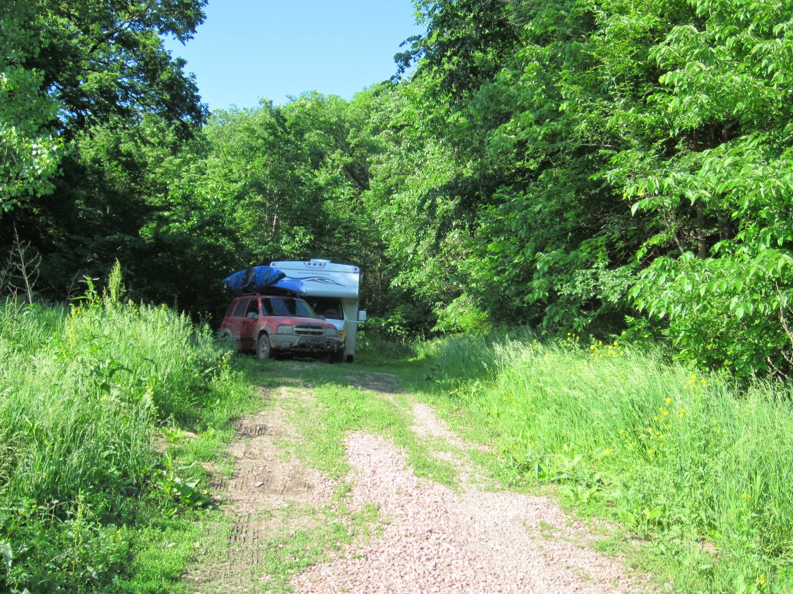


We took the right and after 4 & ½ miles the road dead-ended at a locked gate, in a large pool of thick, gravelly mud, which had already covered the camper and the car. Since you can't back up a towed car, we got out and unhooked the tow hitch, me in my stupid shoes and Kath in flip-flops, getting ourselves covered with mud in the process. Kath put the car in 4wd, got it turned around and drove down the road a ways and waited in case I needed a pull, while I tried to turn the camper around. At 14,000 pounds, it don't do so good in mud-or anything else soft for that matter! It eventually happened, but by the skin of my teeth-this was some really nasty stuff. Kath then found a little clearing in the woods back the way we had come on the right (farms fields and the river on our left), so we stuffed the camper in it, pulled the car in after, and went to bed. It was already dark. Haven't had one of those episodes in years!!!
Where we spent the night
Looking towards the dead end, @ 1/4 mile away
Driving out
Driving out
Still driving out
The
next morning, it was clear and sunny, so we drove back out (after
washing off the windows on the Tracker, which you couldn't see out
of), hooked the car back up and continued west on Rt 12. I spied a side
road, Rt 14H, that went north to a little town named St. Helena, then
west to Rt 81 and Yankton, and the ACOE Gavin Point Dam campgrounds
just south of Yankton on the Missouri. It was a spectacular road, coming up over
a crest with St Helena down below in a little valley, even if it did
change to DIRT right after town! No problems-it may have even shaken
some of the mud off! We went into Yankton, hit a grocery store, then
found a dump station that also had potable water with great pressure, and tried to blast
some of the mud off the rigs-we were only partly successful, and will
need to give them each a real bath when we can. We're now in Yankton
'till Monday, maybe longer-there's a lot to do around here! We asked
the volunteer at the ACOE visitor center if anyone did shuttles to
people paddling the Missouri, as below the dam is a 60 stretch that
is still as it was in L & C's days, or as close as possible. She
didn't know anyone that did that for a living, then offered herself
and her truck for the task! So, next post will be about Yankton, and
we'll let you know how that paddle/shuttle worked out.


Views along Rt 12
Views along Rt 12
Views along Rt 12
Views along Rt 12
View of St Helena just cresting the hill-huge, beautiful church there
Horses on top of the same hill!
Yankton's stockyard mascot


.JPG)
.JPG)
.JPG)
.JPG)
.JPG)


