Thursday, March 27, 2014

Tues. March 18, 2014-K-Camel Lake, Apalachicola NF,  and Basin Bayou, Freeport, FL


We very much enjoyed our time at Camel Lake.  Very pretty place, but a few too many 
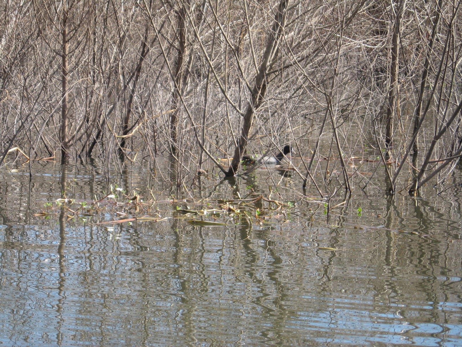
barking dogs.   We had a great campsite on the lake which I did a little paddle on.  Not too much to see.  Quite a few turtles poking their noses out of the water, a hawk (maybe a Marsh hawk?) hanging out in a tree, a couple ducks, 2 American Coots, and a swim noodle in the bushes that I rescued.


Our campsite at Camel Lake.

;


Tom pretending he can read a book.....


A VW bug that came in.  We have never seen a set-up like this in all of our years of traveling.  It was pretty cool! Keeps one out of the snakes, I guess? I wonder what happens when you forget to take it down and just drive off...believe me-some of the things we've pulled on this trip? WE could do it!


Just don't leave the ladder home! (And don't forget where you are when you wake up!)


Our site from the water.


The hawk.


One night I was getting dinner ready and had asked Tom if he could bring out a metal mixing bowl.  He asked "where do you want it"? I told him, "On a hard surface."  He follows instructions well, don't you think? Fruit salad, anyone?


We got an enormous amount of rain while we were there (almost 6”) along with tornado warnings!  Ugh, those really scare the daylights out of me, but the local folk just take them in stride.  I think they hear them all the time, so “No big deal!” they like to say. The day we left though, Tom drove out in the Tracker to see how much water was across the road. It was under water in 7 places, some a couple of hundred feet across and 10" to 12" deep. Luckily, we'd been driving in and out and knew the base was solid and gravelly, so we left without a problem. Tom said, afterwards of course, that all he could think of while driving a 14,000 pound camper through them was of Florida's infamous sinkholes! 

We did a short, 4 mile hike on a Nature Conservancy property to an overlook of the Apalachicola River. It was classic Florida ravine terrain, where spring fed seeps become sandy creeks that flow in very deep (200' to 300' deep) ravines to the river. The trail wound down into and back up out of 2 of them-great workout! The Apalachicola River is the major drainage into Apalachicola bay, which harvests about 90% of the oysters in Florida. The mix of fresh water, and rich sediment from the river and a very shallow, salt water bay it is emptying into, which keeps the salt water warm, makes the oyster beds extremely productive.  They are extremely delicious cooked in the shell directly on hot coals.


On Tuesday, March 18, 2014 we headed out. It was sort of poignant leaving as we are driving out of the eastern time zone for who knows how long, and we are finally heading west, which is always a very exciting thing for us. It always feels good to be driving. Our feet get a bit too itchy if we stay in one place for too long!


We found a really neat spot just west of Freeport, FL, called Basin Bayou.  It is has undeveloped camping on a little 2-track road about 1/2 mile in from Rte. 20. We were the only ones there for the night, and fortunately the weather behaved, as there was a huge dead tree hanging over the camper, we of course realized after we had set up. We have finally got it in our heads to check for that kind of thing, after a piece of dead tree came down through the awning in the middle of the night, at Okefenokee back in November. 


Wednesday, March 19, 2014

Sunday, March 9, 2014-K- Dead Lakes Recreation Area, Wewahitchka, FL


Wow, can't believe it is March.  I don't know where the time went, but it seemed to fly by! We got here a week ago after finishing up our volunteering at the state park.  We would have completed our last project of putting a new roof on the ranger station, but we had some bad weather so that brought things to a screeching halt.  But we probably got it about 80% done.

Our time there ended on a high note when they let us take out the "mule" which is an ATV of sorts, that has a golf cart looking front and pickup truck type bed in the back.  We went on trash patrol up the beach almost to the end of the peninsula.  We had a beautiful crystal clear day and the bay was dead calm and also crystal clear.  We had a great time. Once we got away from the campground a couple miles or so, we felt like we were the only inhabitants on a tropical island!  We couldn't quite get to the end of the peninsula because we had to cross a flow of water and we didn't want to get the mule in the salt water, also the area looked like it was blocked off by the state biologist at the park, due to the nesting of Plovers.

We saw the usual assortment of birds, but the interesting thing is we saw loons out in the Gulf.  According to Ken, the host in our CG, who is quite knowledgeable about Loons habits, they winter down here and the young ones stay here for about 3 years before they head back up north.  Shortly after we got to St. Joe St.Park, I heard a loon and couldn't believe my ears.  Then Ken told me they are here for the winter.

And yes we did pick up trash-filled the back of the mule to overflowing!  Didn't find anything that would make us millionaires, but lots of shoes and coconuts and of course lots of plastic bottles. Most of it comes in during storms, a good portion of it from across the Atlantic, as the assistant park manager Danny explained to us before we left on the run. Many people take fishing poles instead of trash bags, which Mark (the park manager) informed us was okay as long as you come back with more trash than fish! It's a necessary job, but also a bit of a perk, so we we're thrilled to be able to do it once.

You can watch a video of why seniors should not drive a mule here : >)
I found some sea beans.  The one on the right is called a hamburger bean! These are seed pods that come all the way from Africa!  The smaller on is about the diameter of quarter.


Heading out on the beach with the "mule".


Palmettos on the beach.  We felt like we were on a tropical island.


 The water was crystal clear and the calmest we had seen it in a long time.


Animal tracks. Not what they were, possibly raccoons.


Fresh water pond at the northern end of the peninsula.


Just to prove we did get trash!


A picture of our campsite at Dead Lakes.


Quite a difference in the weather 60 miles north.  Quite a bit warmer, much less humidity and NO BUGS AND NO SAND!!!! Our co-volunteers, Dianne, Bill, Ken and Patti came up yesterday for a cook-out. We had a beautiful afternoon just hanging out by the fire.

We also got the news a couple days ago that we will be the hosts at KOFA wildlife refuge in SW Arizona for next winter.  Here is a couple of links, the first is on to what to do there, and the second takes you to some spectacular images posted on Google:


We will be there from late Oct. through March 2015.  We are about 20 miles south of Quartzite and about 60 miles north of Yuma.  We will be dry camping, no electricity, they supply a water tank, propane and a 4wd truck.  We will be checking on places people have camped and clean-up if necessary.  We have the option of leading short guided hikes to an area that has palm trees, we also could be monitoring old mines for bat population at night.  They supply us with night vision goggles.  They also are reintroducing pronghorns into the area that we may have a hand in helping with. There is a full time wildlife biologist with a PhD on staff, so we hope to get some good education from her on desert life there, and in general. It is still Sonoran desert, which is what surrounds the Tucson area, and our favorite of the 3 desert types we've been in over the years.

Definitely a much different gig than what we did this winter! 660,000 acres of mostly desert wilderness, and more nature driven, which will be a lot of fun and educational.

We will be here for a few more days and then head east to the National Forest of place called Camel Lakes. A nice little CG on a small pond.

Hopefully we can get the blog caught up!


Friday, March 7, 2014

Feb. 16, 2014-Port St. Joe, FL-K-

Has been pretty quiet since the last post.  We have been getting projects done here in the campground.  We put 3 new roofs on various buildings.  Our next project is the entrance station.  This one will be a little harder as we will be working around traffic and is more in the public eye!  It isn't a big building, just has a lot of different angles and valleys that we haven't had to deal with in the other buildings.   Keep your fingers crossed.

So, I am going to show a my nerdy side.  Tom had given me a portable weather station for Christmas as I couldn't bring the one we had at the house.  I am going to torture all with the monthly statistics for January. Tom is used to this.

High temp:72
Low temp:22
High Wind:18
Wind Chill:18
Avg. High Temp:57.35
Avg. Low Temp:41.70
Avg. Temp:50
Precipitation for the month:5.09

(Thank God she left out sunrise, moonrise, sunset, moonset, and high and low tides....:>)

When we had the cold snap with the sleet in January, they had to rescue turtles again from the bay.  A couple weeks ago we were told they were going to release them out on the beach.  A group of us went down to watch.  They had about 130 to be let go.  It was really neat.  They were pretty happy to get back out in the water.

Here is a couple of videos I took, one of one of the larger ones getting released
.   They put all the big ones in kiddie pools!


Last Sunday on the 9th, we headed north of Port St. Joe, to Wewahitchka (Wewa for short) and kayaked the Dead Lakes Recreation Area.  Very interesting place.  All Cypress trees.  There were a few fisherman out. The water was like glass.  The lighting was really neat.  Big puffy clouds, a little blue sky against the grey of the trees and dark water.  I hope one of my pictures captured it.

We were anticipating seeing a lot of birds.  But it was dead quiet.  We came upon a bunch of ravens squawking in the trees and I saw a large nest on top of a dead tree, a couple turtles sunning themselves, but that was it.  Not sure if that is normal or just the time of year.

Here's a link to a 30 sec. video of the paddle:


Monday, March 3, 2014

January 29, 2014-Thurs-P.St. Joe, FL-K-

They said it would happen and it did.  The ground is covered with sleet!!  They were predicting snow, but I think that was for the northern panhandle.  It has been between 30 and 32 degrees all day.  Yesterday most of the counties here closed their schools.  Some major bridges were closed due to ice on the roads.  Who woulda thunk!

It wouldn't be too much of a problem, but my good cold weather gear is home and we had to work in the bad weather today.  Granted we were undercover, but it was a 3 sided building so it was cold.  But it worked out fine.  

We worked on a dump truck that the bed is all rusted as a result of the salt air.  It is unreal how much havoc it does to vehicles down here.  In the north we have salted roads, down here the salt air.  Tom cut the rusted floor off of it while I sanded the body with a power sander.  

There are a few tenters here and I don't know how they are getting through this cold weather.  I would be looking for the nearest hotel with a hot, hot, shower!

The Campground host Ken, has been giving me all sorts of extra clothes to wear!  I have my Bean boots, but they are just rubber and no insulation, and being on a cement floor all morning, I couldn't feel my toes. Just like having plastic ski boots on!  He dropped of a pair of warmer looking boots for me this afternoon as we will be working outside tomorrow  along with a pair of heavier socks.  I feel like such a wuss. (not sure how to spell that word!)

The pictures should tell a better story.

This post is LONG over due as our internet has been almost worse than dial-up and getting anything to happen is like watching paint dry.

Here are some pictures.


We are surprised our screen house survived!


They closed the ramps to the beach it was so icy.


I never thought I would see ice on the sea oats!


Sunday, January 19, 2014

2010 Crestone Needle Hike

Since we are now hunkered down for two months as volunteers at St. Joseph Peninsula State Park, and also hunkered down with the weather, we thought we'd put up some posts from past trips & past hikes. In late August of 2010, we were at our land in Colorado. We hiked up to South Colony Lake, which is at the base of Crestone Needle, one of Colorado's 53, 14,000 foot high peaks-this one is 14,203 feet to be exact, and the lake is at 12,000 feet. We hadn't done this climb in years, and it's kind of rugged, the trail starting at 9000 feet in elevation, and climbing steadily for about 4 miles to the lake at 12,000 feet. Crestone Needle itself is a technical climb, and some say the most difficult of the 14,000 footers. On average, 2 to 4 people are killed up there each year, and we always know when there's trouble, as a rescue helicopter from Fort Carson Army Base will come thundering over our property when we're there, and we can often watch it all the way to the peak.

This hike is sort of near our land in Westcliffe, Colorado, the trailhead being about 8 miles south of the town of Westcliffe, and about an hours drive from "camp". You can see the peak in the picture below, taken from the deck on our property:

If you go straight up and slightly right from "Long Pants Bob's" telephone pole, out thar in the trees, you'll see a big flat topped mountain, Humboldt Peak. The next peak to the right of it is Crestone Needle, with the distinctly pointed top and South Colony Lake is at at the base of Crestone Needle. (Don't forget you can click on any picture and it will bring up all of them in an enlarged slideshow-much better way to see them. Keep clicking each pic to move to the next one, and click anywhere off the pictures to return to the story).

When you turn off Rt. 69 south of town, you start out on a good county road, which turns kind of gnarly when you cross the line into the National Forest and county road maintenance stops. The road stops at a parking area in thick woods, and the trail starts at a foot bridge crossing a creek there, and actually continues on in the bed of the discontinued part of the road (You used to be able to drive further on a good part of the way, in a high centered 4wd, but the Forest Service banned motorized travel years back when the entire top of the Sangre range was designated a wilderness area-above a certain elevation is the delineator, I believe.) 

You hike about a mile to a mile and a half in the old roadbed, where you come to a choice-continue on the road and a longer but less steep climb, or go right and up a trail that is a more direct route that is a workout! We went thataway. To be honest, it had been SO long-about 10 years maybe?, and my knee had gotten trashed in a rafting trip about a month & a half before, I wasn't sure if I would be able to finish it or not! Not too far along this trail, you start hiking in and out of the treeline, and the views start to open up.


Along the way, we ran into some four legged company, who, as you can see,  were not real concerned about us showing up in their territory. (The first pic is the Needle).


At this point, we were completely above treeline, and it is probably the most spectacular place we've ever hiked to in the mountains. Humboldt is towering over you on your right, straight ahead is a very high wall that connects Crestone Needle with Crestone Peak, and slightly left and the end of that wall is Crestone Needle itself, rising straight up out of South Colony Lake for 2200', almost a half mile.


For you skeptics, that is an altimeter on the watch! We were lucky that day, as it was dead calm and warm. Often you get there just in time for a thunderstorm to blow up over the ridge, so it cold, windy and wet, and has you scurrying for cover. The weather there is treacherous, where you are at 12,000' and the storm is directly over your head, and often times still growing in size. The Sangre De Cristo's are a narrow range, and on the backside of that wall connecting the peaks is a 60 mile wide valley, the San Luis Valley, that's at 5000' and very hot in summer. The winds blow across it and get hoisted up and over the 12 to 14,000' elevations, causing afternoon storms almost daily, that soak the Wet Mountain Valley where Westcliffe & Silvercliff are located, and our property is, 11 miles further away on the east side of that same valley. 


This last pic above is an aerial, looking north at Crestone Needle's peak, and down to South Colony Lake. The hike out goes fast, and you certainly have earned a cold one or two, when you get back to camp and collapse in a chair!